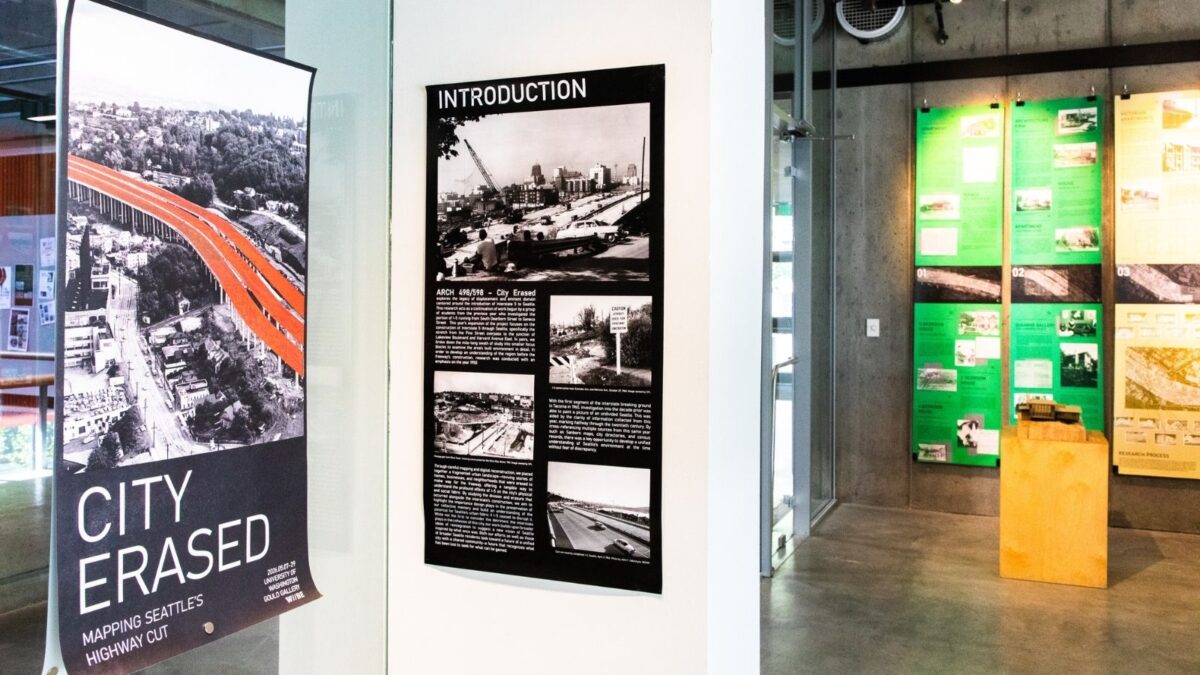
On a walk along Interstate 5, it can be difficult to imagine what existed before the concrete trench divided Seattle in two. Traffic roars through the corridor now, cutting across neighborhoods from Eastlake to the Chinatown–International District. Before the freeway arrived, the landscape was stitched together by homes, corner stores, stair streets and tightly connected communities.
A new student-designed exhibition at the University of Washington College of Built Environments is working to bring those lost places back into view.
CITY ERASED: Mapping Seattle’s Highway Cut on display in the Gould Gallery from May 7-29th, 2026, explores the legacy of urban revision and displacement caused by the construction of I-5 in Seattle. The project reshaped neighborhoods, displaced communities and transformed the city in the name of progress. Through archival research, mapping and digital reconstruction, students are rebuilding a portrait of the city as it existed before the freeway’s construction.
For Department of Architecture Lecturer Elisa Renouard, who leads the project, the work is deeply connected to conversations happening in Seattle today about reconnecting communities, revising zoning, and repairing the urban fabric through proposals to lid portions of I-5.
“Seattle is a place defined by major earth movements and projects,” Renouard said. “The topography and urban fabric reveal the story; I-5 was a major cut, creating a canyon through the city. And now a new proposal, the talk that’s happening around lidding I-5, may well be the next big Seattle project.”
But CITY ERASED: Mapping Seattle’s Highway Cut is not simply a study of infrastructure. It is an investigation into everyday lives and the stories embedded in the city’s built environment.
“This research allows us to hone in on the very human-scale stories of the city,” Renouard said. “It’s not just a study of buildings considered architecturally important. It’s understanding the richness of a diverse urban fabric, who was living in the city, what their stories were and what it felt like to live here.”
Related coverage
CITY ERASED was recently featured in The Seattle Times’ Pacific NW Magazine.
Additional community coverage is available through Seattle Now & Then.
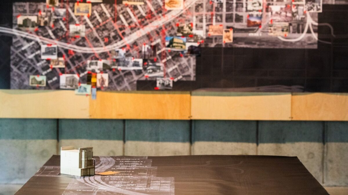
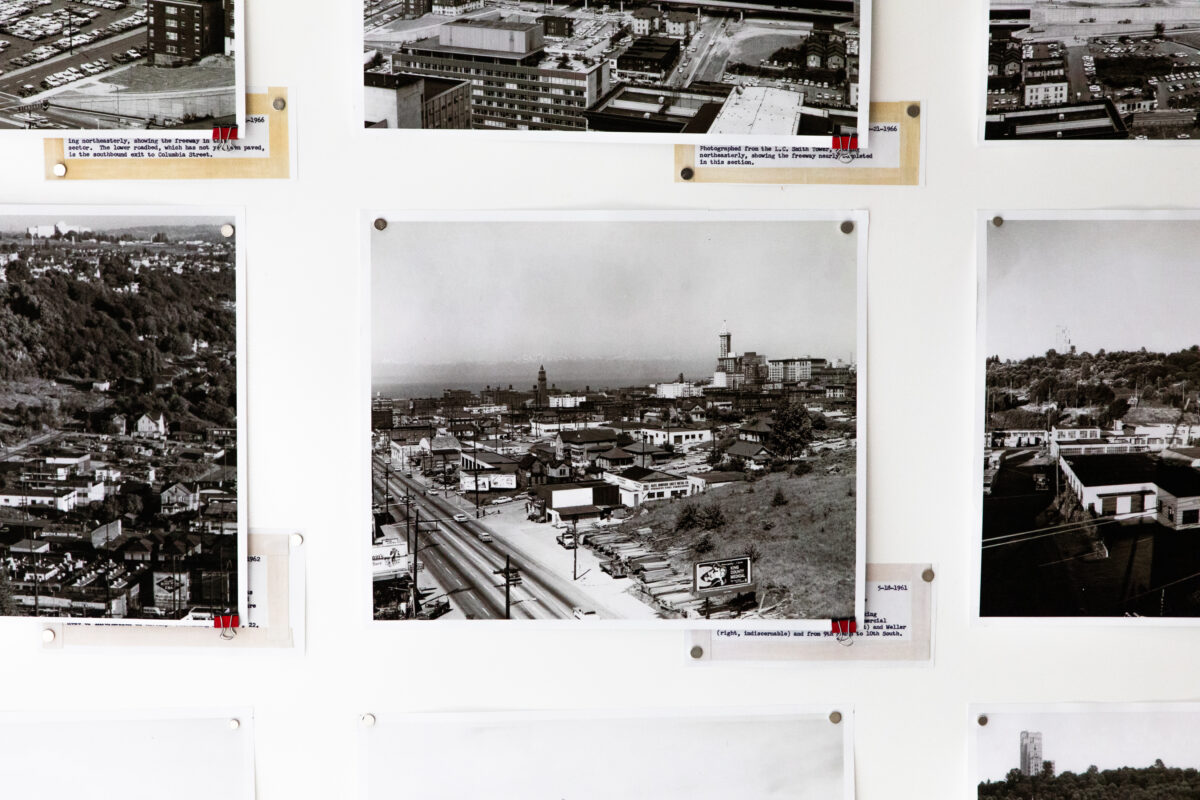
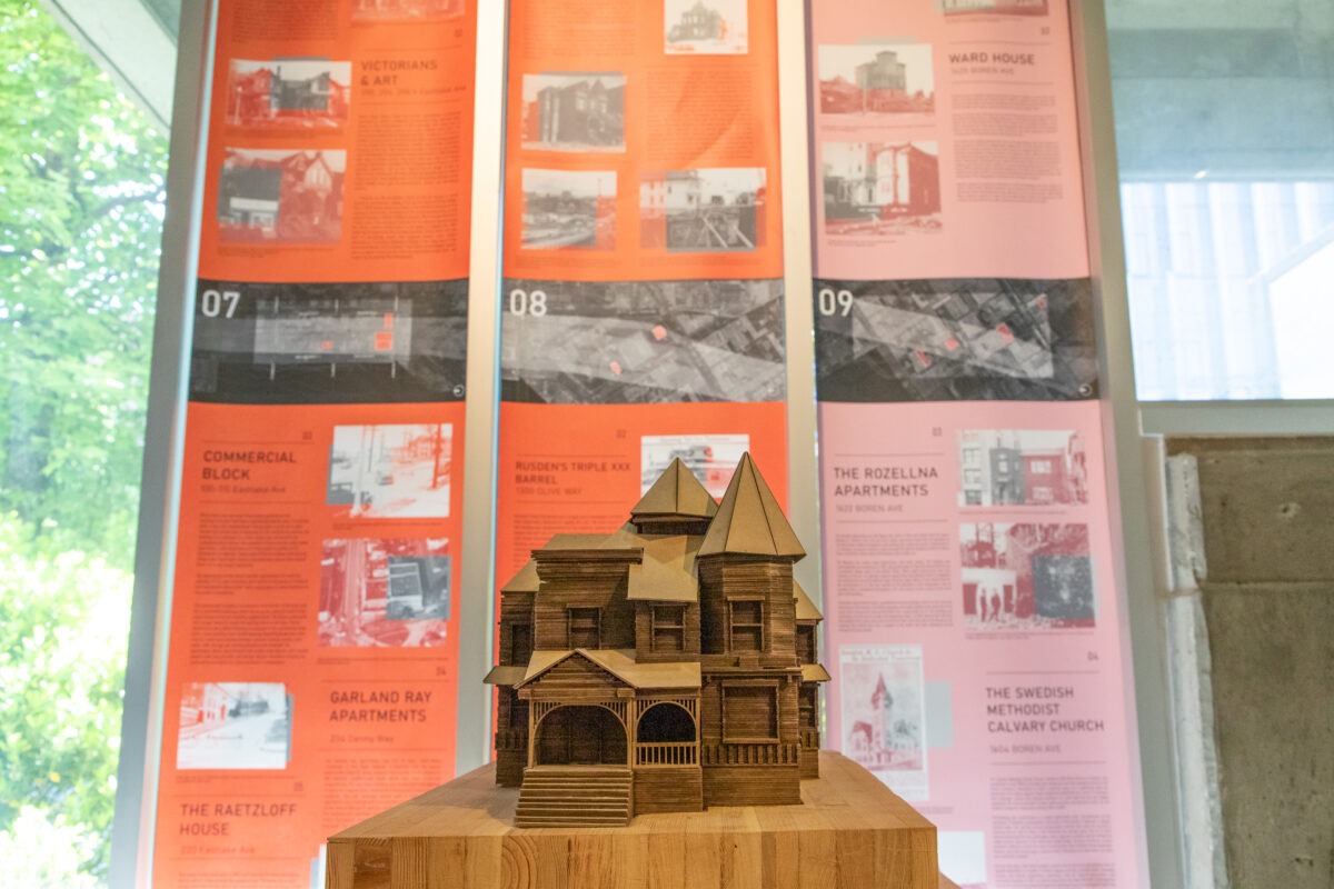
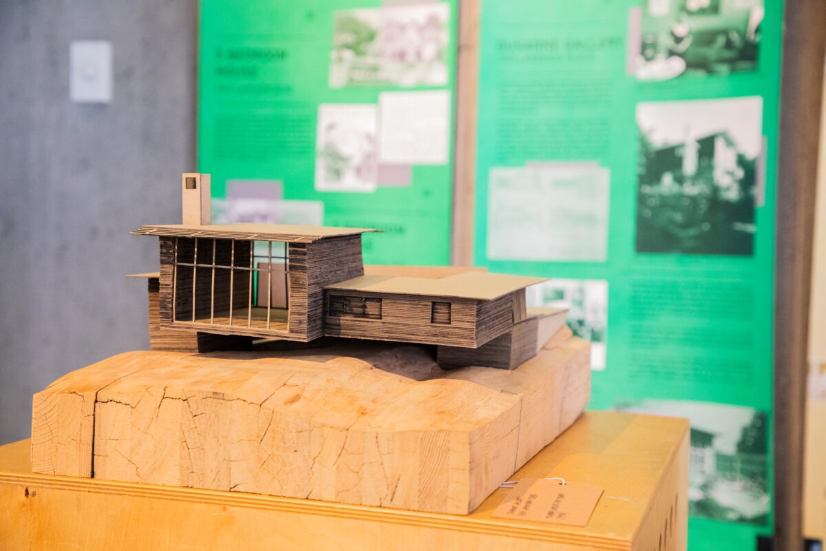
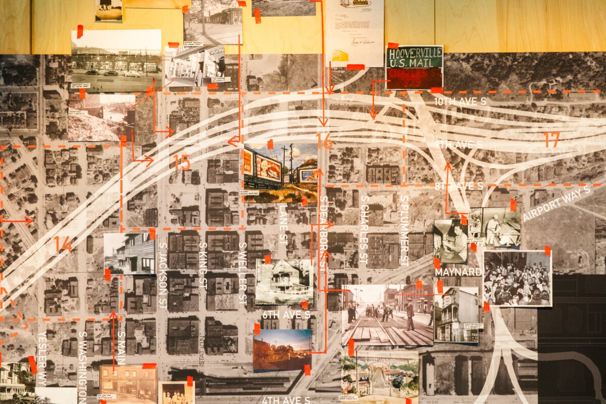
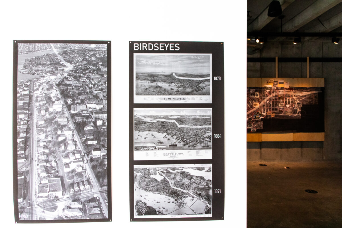

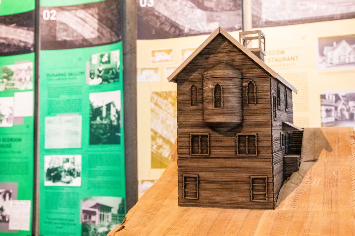
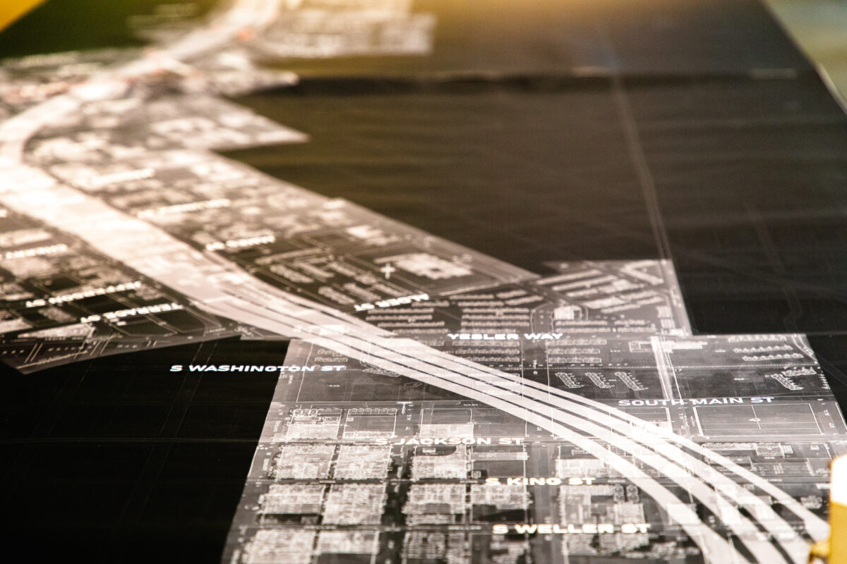
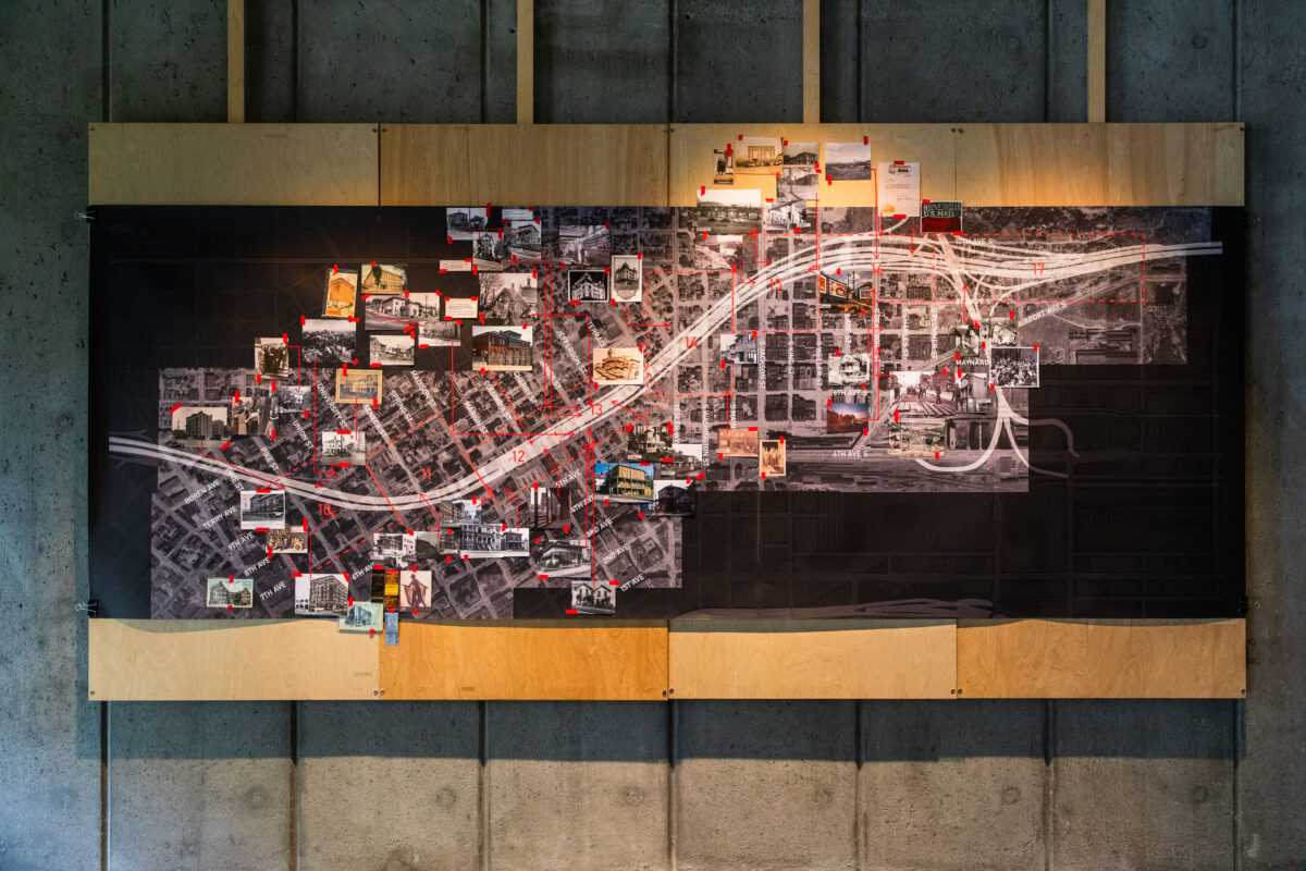
Students in the project comb through Sanborn fire insurance maps, census records, newspaper archives and city directories to reconstruct the neighborhoods lost to the freeway’s path. They work in pairs along different segments of the I-5 corridor, tracing both the physical landscape and the social histories erased alongside it.
For student Fernando Herrerias-Reyes, the project revealed how cities are continuously rewritten, often unevenly. “This work shifted how I understand cities as something that is constantly being rewritten, often at the expense of certain communities,” he said. “It made me more aware that design decisions are not neutral and can have long-term social consequences.”
The research process itself has become a powerful part of the learning experience. In an era increasingly shaped by digital tools and artificial intelligence, the project asks students to slow down and engage directly with physical archives and historical records.
“There’s something so tangible, so physical about archival work,” Renouard said. “The students are each going on these almost archaeological digs to uncover and find ties between things. It’s a very human experience.”
That process has also created unexpected connections between past and present.
While researching online community history groups, Renouard encountered a man describing the home his family lost to the construction of I-5 when he was a child. She realized she had archival photographs of the house and sent them to him.
“He said, ‘Yes, this is where I lived when I was five or six years old,’” Renouard recalled. “And in one of the photos, there’s actually a boy and a girl playing on the back porch. He said, ‘That’s me and my sister.’”
The exchange opened a deeply personal window into the neighborhood that once stood there. The man remembered sleeping with windows open during summer nights and hearing neighbors coughing through the walls of the dense working-class community. He remembered being sent to the corner grocery store to buy milk for his mother. The students had also located the store in archival photographs.
“These small things are truly exciting to uncover,” Renouard said. “The students really feel that this is meaningful work, that they are uncovering stories of the built environment that might otherwise be lost to history.”
For student McNielle Galindo, the project’s significance lies in preserving those fading stories before they disappear entirely.
“City Erased is a project that matters right now because it assembles a record of recent, yet unfamiliar stories that are fading,” Galindo said. “These stories, however small, make up the history of Seattle.”
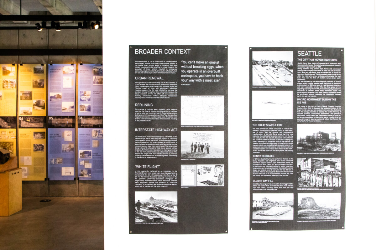
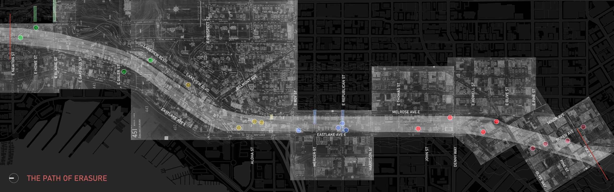
The project also asks broader questions about urban planning, equity and the long-term impacts of infrastructure decisions. Students are examining how the freeway disrupted pedestrian movement, altered neighborhood connectivity and intensified patterns of displacement already shaped by redlining and socioeconomic inequality.
One of the first exercises in the course is simply walking the freeway corridor itself.
“What’s very apparent is how difficult it is to move from one side to the other,” Renouard said. “Historically, there were many more pedestrian connections, public stairs and pathways that allowed neighborhoods to function differently.”
By reconstructing what once existed, the exhibit encourages visitors to reconsider what cities value and what they sacrifice.
“Reading the history of the city allows us to approach design with a holistic sensitivity toward past, present, future,” Renouard said. “Understanding the way things were allows us to move forward and better imagine the next layer of the city palimpsest.”
As Seattle debates how to reconnect neighborhoods divided nearly 70 years ago, CITY ERASED positions historical research as more than an act of preservation. It becomes a tool for imagining a more connected, equitable and human-centered future.
The exhibit ultimately asks visitors to look closely at the city around them, not just as it exists today, but as a layered landscape shaped by memory, loss and the possibility of repair.
CITY ERASED: Mapping Seattle’s Highway Cut will be on view in Gould Gallery from May 7–29, 2026, with a closing reception on May 28 from 5:30–7:30 p.m. RSVP requested.